
MeT forecasts extended wet spell till Feb 21
Fayaz Bukhari/Gopal Sharma
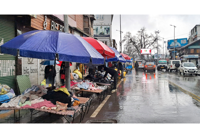
SRINAGAR/ JAMMU, Feb 18: Rain lashed parts of plains in Kashmir while higher reaches of J&K including Gulmarg, Kupwara, Bhaderwah and Poonch received snowfall amid extended forecast for wet spell in the region till February 21.
Click here to watch video
The higher reaches of Kashmir had snowfall and the Valley was lashed by rains today bringing down the day temperatures that settled below normal for most of the places in the region. It was snowing in the hills and raining in the plains tonight.
The Sadna Top in Kupwara district had over one feet of snowfall this evening, Furkia Top and ZGali in the district recorded over two feet of snowfall. Kongamdori Gulmarg in Baramulla district had over one feet of snowfall, Gulmarg over 6 inches and Baba Reshi around 2 inches of snowfall.
Gurez and Dawar in Bandipora district had around 2 feet of snowfall and Razdan Top over two feet.
– Excelsior/Shakeel
The night temperatures increased by several notches today and stayed several degrees above normal. Srinagar recorded a low 5.8°C against minus 3.0°C on the previous night. It was above normal by 4.8°C for the city for this time of the year, he said.
Qazigund recorded a minimum of 3.8°C against minus 1.0°C the previous night and it was 3.9°C above normal for the town. Pahalgam recorded a low of 2.5°C against 0.7°C the previous night and it was 6.9°C above normal for the resort.
Kokernag recorded a minimum of 5.0°C against 2.0°C the previous night, Kupwara 2.4°C against 3.3°C on the previous night while Gulmarg recorded a low of minus 1.4°C against minus 1.2°C the previous night and the temperature was above normal by 5.4°C for the skiing resort.
Srinagar recorded a maximum of 7.5 degree Celsius temperature today which was 2.4 degree Celsius below normal; Qazigund 10.3 degree Celsius, Pahalgam 4.5 degree Celsius, Kupwara 5.3 deg C; Kokernag 10.0 degree while Gulmarg recorded a maximum of 0.3 degree Celsius, which is 0.5 degree Celsius below normal for the place during this time of the year.
The 20-day-long winter period called ‘Chillai-Khurd’ ended today and this is followed by a 10-day-long period ‘Chillai-Bachha’ (baby cold) which starts on February 19 and lasts till February 28.
Many parts of Jammu are experiencing rain since this morning and hilly areas of Kishtwar, Doda, Bhaderwah, Ramban, Poonch and Udhampur witnessed snowfall this evening.
Reports said that higher reaches of Dudu-Basantgarh, Bani Sub Division, Bhaderwah, Paddar and Chhatroo, Banihal and Surankote in Poonch witnessed fresh snowfall. Pir Ki Gali on Mughal Road, Sinthan Pass in Kishtwar/ Kokernag and Chattergalla on Bhaderwah-Bani road witnessed about 1.5 to 2 ft snowfall this evening.
Jammu City and its adjoining areas witnessed moderate rain since this afternoon. The rain, however, stopped late this evening. A sharp fall in temperature has been witnessed. The Jammu-Srinagar National Highway, was, however, open for traffic.
A MeT spokesman said that Jammu recorded a minimum temperature of 13.0 deg C and maximum 17.1 degrees, Katra Mata Vaishnodevi minimum 11.8 and maximum 16.0, Bhaderwah minimum 2.4 and maximum 14.0 while Banihal town a minimum temperature of 7.0 and maximum 12.0 deg C temperature today.
Meanwhile, the weatherman has forecast an “extended wet spell” in Jammu and Kashmir till afternoon of February 21.
Under the influence of the weather systems, he said, an “extended wet spell” is likely till February 21 (Afternoon), most likely over J&K and adjoining areas.
In Kashmir valley, he said, generally cloudy weather with possibility of light to moderate rain and snow is expected at many places on February 18.
From February 19-20, he said, there is possibility of light to moderate rain and snow at most places (plains and lower reaches) with possibility of heavy snowfall over middle and higher reaches of Kupwara, Baramulla, Bandipora, Ganderbal, Badgam, Shopian and Kulgam districts during late afternoon of February 19 to February 20 late night.
From February 21, he said, there is possibility of light to moderate snow at many places till afternoon and late afternoon and gradual improvement thereafter.
Regarding Jammu division, he said, there is a possibility of light rain and snow at many places in the next 24 hours.
“From Feb 19-20, there is a possibility of intermittent light to moderate rain with thunder/lightning in plains of Jammu Division with light to moderate snowfall over higher reaches and heavy snowfall over isolated higher reaches of Ramban, Poonch, Doda and Kishtwar,” he added.
On February 21, he said, light to moderate snow/rain/thunder storm /lightning is expected over many places till late afternoon and evening and gradual improvement thereafter.
The MeT office also issued an advisory, saying that the system may lead to temporary closure of roads of higher reaches and important passes like Sinthan, Mughal Road, Sadhna, Razdan, Zojila etc.
“Travellers are advised to plan accordingly,” the MeT official said, adding, “farmers are advised to withhold irrigation and fertilizer application and drain out excess water from orchards and fields during the above period.”