
New Delhi, July 31: China has completed the construction of a 400-metre bridge, connecting the northern and southern banks of the Pangong Tso. The high-resolution images of this bridge were first published on ndtv.com in January 2022. The new satellite images from July 22, 2024, show vehicles on the black-topped bridge and moving across the banks of Pangong Tso.
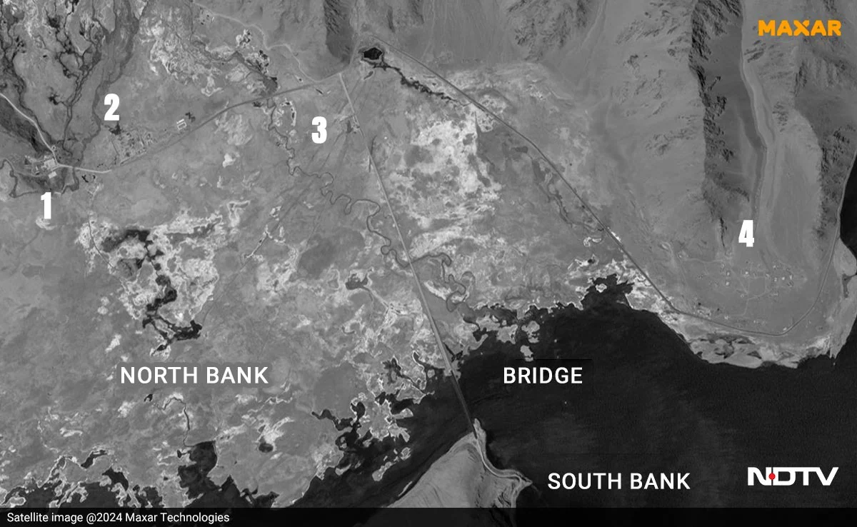 New satellite images show four structures on the northern side of the lake. The bridge lies in territory held by China since 1958 near the Line of Actual Control in Ladakh.
 Khurnak Fort lies on the northern shore of Pangong Tso and has been in Chinese-held territory since 1958. Before 1958, the boundary between India and China was considered at the Khurnak Fort but the latter has wrested control since then. The construction at Khurnak does not represent an incursion being presently held by India.
 The satellite image shows a Chinese fortification along with two helipads at Khurnak Fort. During the 1962 India-China war, the Chinese used the Khurnak Fort as its forward headquarters for operations in Ladakh.
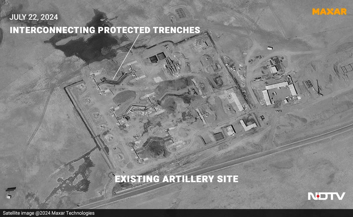
Another satellite image shows an existing artillery site. The Chinese have also built interconnected protected trenches that run north to south.
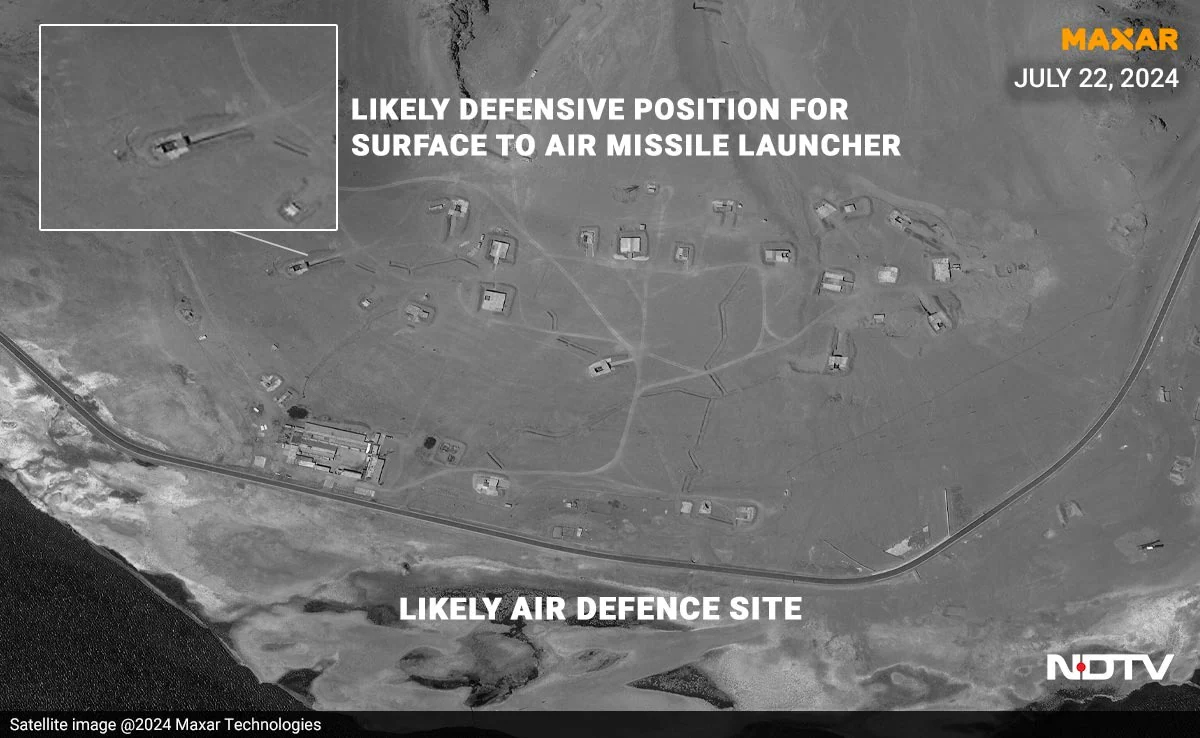
 A satellite image shows an open defensive position, a likely site of a Chinese surface-to-air missile launcher, erector and transporter. An air defence site can also be seen in the image. A road runs parallel to the bank of Pangong Lake to transport troops and equipment.
 The Chinese bridge has cut the travel distance between both banks by 50-100 kilometres, or several hours in travel time.
Asked to respond to the latest developments, the External Affairs Ministry directed NDTV to a previous statement: “This bridge is being constructed in areas that have been under illegal occupation by China for around 60 years now. As you are well aware India has never accepted such illegal occupation.”
Beginning in May 2020, Indian and Chinese soldiers had a series of violent skirmishes along the Line of Actual Control in Eastern Ladakh. 20 Indian soldiers were killed in action in the Galwan Valley which lies to the North of the Pangong Lake region being described in this report. China claims four of its soldiers were killed in the fighting though investigative reports have indicated that the true number was closer to 40 dead.
Soldiers from both sides also violently clashed on the North bank of the Pangong Lake though India and China agreed to reduce tensions in the area by creating a demilitarised zone which saw China remove dozens of structures that they had created between “Finger 4” and “Finger 8” – spurs which protrude into the Lake which are used as geographical markers to identify parts of the Northern bank of Pangong. (Source: NDVT)