Excelsior Correspondent
-Excelsior/Pic
TANGHDAR (Kupwara), Mar 28: Kashmir valley was today lashed by heavy rains while upper reaches had fresh snowfall and weatherman has forecast more rains and snow for next one week.
The Director Meteorological Department, Sonam Lotus, told Excelsior that a western disturbance is over the Jammu and Kashmir that will bring rains and snow in the State. “It will persist over the State for two days and will bring rains from today with heavy showers tomorrow morning and will last for two days”, he added.
Lotus said that one more western disturbance is approaching the State on April 1 and it will last for 48 hours and will again bring rains in the State with snowfall up in the hills”, he added.
The MET director said weather system may disrupt surface and air transport during the freak weather. “There will be significant decrease in day temperature and slight rise in night temperature,” he added.
The rains have led to increase in the water level in river Jhelum and its tributaries. The rising waters have caused concern among the last year’s flood victims as the breaches have not been fully plugged yet.
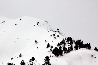
The rains in Kashmir valley led to drop in the temperature and fresh snowfall in upper reaches including Sadna Top in North Kashmir led to icy weather conditions in the hills.
It was snowing intermittently in Sadna pass and Eagle mountains in Tanghdar area. The continuous snow and rains led to snow and mudslides on Kupwara-Tanghdar road. However, Border Roads Organization (BRO) immediately cleared the slides for one-way traffic.