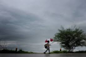
NEW DELHI: La Nina seemed to have played a critical role in influencing the country’s weather in 2020 which was a second consecutive year of above normal rainfall with below normal temperatures in the winter and less occurrence of heatwaves.
The year also saw formation of five cyclones in the seas along eastern and western sides. Of the five, four were ‘severe cyclonic storms’ and above.
La Nina conditions played an important factor in having a good monsoon and severe winter conditions in parts of north India.
La Nina is associated with the cooling of the Pacific waters — El Nino is antithesis to it. It is generally observed that a La Nina year also receives good rainfall and winter temperatures are lower than normal.
December to February are peak winter months in the country. The severe cold day conditions in parts of north India that began in December of 2019 also continued in January this year, India Meteorological Department (IMD) Director General M Mohapatra said.
The trend of cold to severe cold day conditions also continued later in October, November as well December. Several parts of north India recorded below normal temperatures from October to December, he said.
On the other hand, the summer also saw few instances of heat waves that affect large portions of the country from April to June, Mohapatra added.
He attributed the low frequency of heatwaves to frequent Western Disturbances — cyclonic circulation that originates in the Mediterranean Sea, traverses across Central Asia, and brings non-monsoon rains to northwest India during the winters.
This year, the frequency of western disturbances was unusually high and continued even during the summer.
2020 was also the third to record highest precipitation in the last 30 years.
Southwest Monsoon arrived over Kerala on June 1, its normal onset date. The official monsoon season starts from June 1 to September 30.
The country received 109 per cent rainfall of the Long Period Average (LPA) with three of four months — June (118 per cent), August (127 per cent) and September (104 per cent) — witnessing above normal rainfall, while July recorded (90 per cent) deficient rainfall.
Generally, the country receives maximum rainfall in July and August.
One of the main features of the monsoon was the rainfall in August. The month saw five low pressure areas (cyclonic circulations) that brought large amount of rainfall over central India.
The total number of low pressure days was 28 against the normal of about 15 in August.
It caused two-three spells of riverine floods over Odisha, Telangana, Madhya Pradesh, south Gujarat and south Rajasthan.
The IMD said it was a record rainfall in August 2020, when all-India rainfall was 127 per cent of LPA. It was the highest in the last 44 years, after August 1976 (128.4 per cent) of LPA. It was also the fourth-highest in the last 120 years.
Overall, during the monsoon season 2020, a total number of 12 low pressure system formed.
Nineteen states and union territories received normal rainfall this year, while nine states and union territories saw excess rainfall. Bihar, Gujarat, Meghalaya, Goa, Andhra Pradesh, Telangana, Tamil Nadu, Karnataka and Lakshadweep islands recorded excess rainfall. Sikkim recorded large excess rainfall.
However, Nagaland, Manipur, Mizoram, Tripura, Uttarakhand, Himachal Pradesh, Jammu and Kashmir recorded deficiency. Ladakh recorded large deficiency. Delhi also received deficient rainfall.
“Considering the recent years since 1990, the all India seasonal rainfall this year was third highest, after 112 per cent of LPA in 1994 and 110 per cent of LPA in 2019.
“It is consecutively for two monsoon years, when India received good rainfall of 9 per cent of the LPA or more. Thus, 2019 and 2020 are the two consecutive above normal monsoon rainfall years, after 1958 (110 per cent of LPA) and 1959 (114 per cent of LPA),” the IMD had said after the end of the monsoon.
Southwest Monsoon covered the entire country on June 26 against the normal date of July 8, 12 days before its normal date. The withdrawal was also late. It retreated from west Rajasthan and parts of Punjab on September 28, 11 days after its normal withdrawal date.
Overall, the Northeast Monsoon too has been good so far, Mohapatra said. The Northeast Monsoon brings rains to Tamil Nadu, parts of Andhra Pradesh, Kerala and Karnataka from October to December.
“The year 2020 was a good rainfall year. The country also received good rainfall during the winter months. The Southwest Monsoon as well as the Northeast Monsoon was good,” Mohapatra added.
Three of the storms (Amphan, Nivar and Burevi) formed in the Bay of Bengal and the other two (Nisraga and Gati) in the Arabian Sea. Amphan, Nivar and Nisarga hit the Indian coasts as cyclonic storms.
After nearly two decades — 1999 Super Cyclone of Odisha that killed thousands of people –, the Bay of Bengal saw formation of another super cyclonic storm Amphan in May. However, as it pummelled the West Bengal and Bangladesh coasts as an extremely severe cyclonic storm, its intensity had reduced marginally.
But will a similar weather pattern continue in 2021? Mohapatra said La Nina conditions are likely to prevail for the next six months.
The IMD in its winter forecast for December 2020 and January February 2021 also predicted below normal temperatures in north India.
And how will La Nina affect the Southwest Monsoon and the summer?
“It is difficult to predict the weather for the entire year at this point of time. But La Nina is generally associated with good monsoon and below normal temperatures during the winters. We are continuously monitoring the situation,” Mohapatra said. (AGENCIES)


